

Atlas · physical geography
Geology & Landforms Atlas
These plates distinguish generalized Quaternary geology from bedrock contacts, glacial-landsystem boundaries, and Critical Dune Areas. They are a guide to the scale and source of each layer, not a parcel, subsurface, or regulatory determination.
For the evidence ledger and interpretive limits, read geology and landforms.
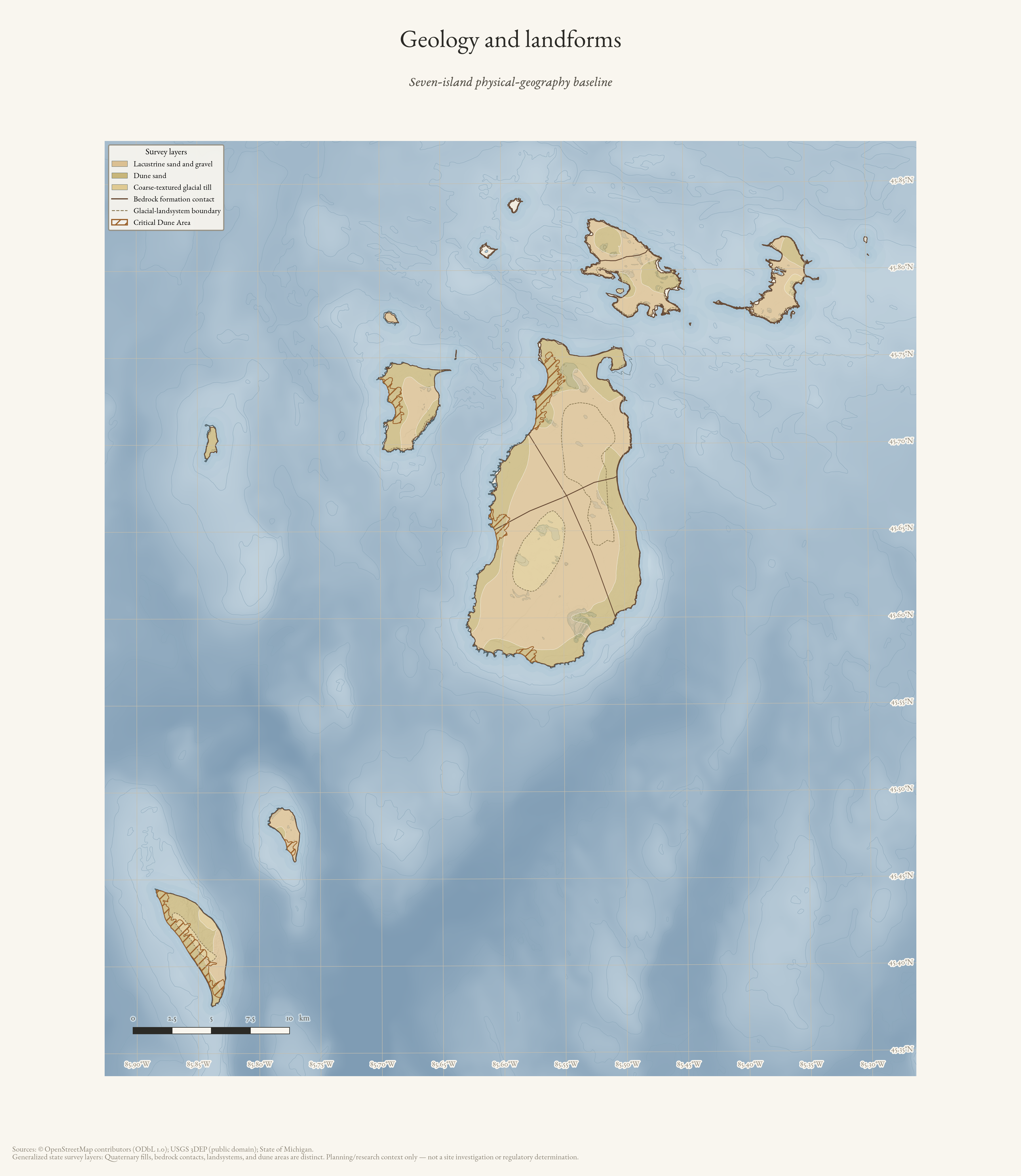
Geology and landforms
Seven-island physical-geography baseline: generalized Quaternary units with distinct bedrock, landsystem, and critical-dune survey symbols.
Drawn from the archive's own data in EPSG:3078. Map data © OpenStreetMap contributors (ODbL 1.0); Michigan Geological Survey Quaternary and bedrock geology, glacial landsystems, critical dune areas, and USGS 3DEP (public domain).
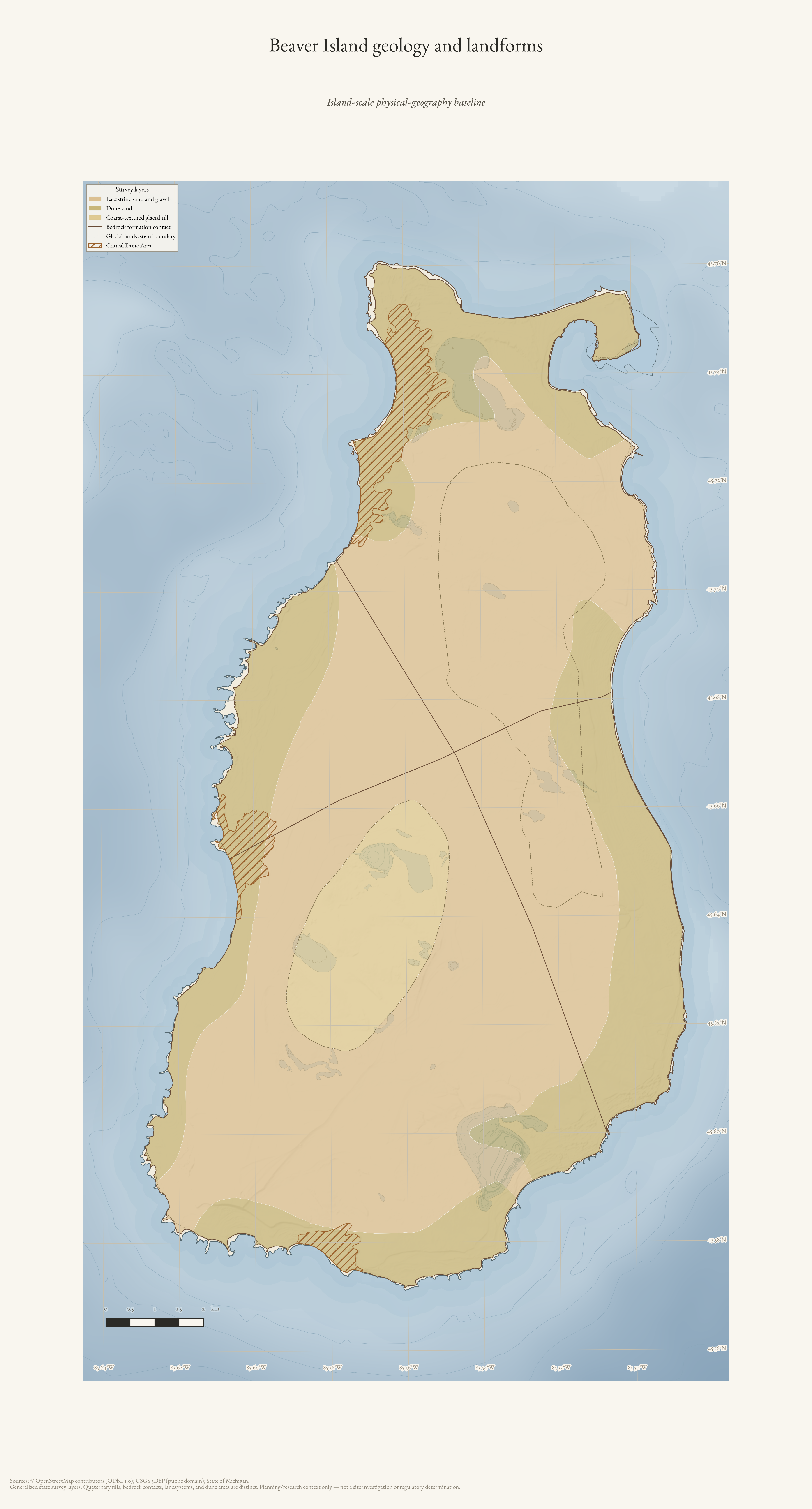
Beaver Island geology and landforms
Island-scale physical-geography baseline for Beaver Island: generalized Quaternary geology and separately symbolized survey boundaries.
Drawn from the archive's own data in EPSG:3078. Map data © OpenStreetMap contributors (ODbL 1.0); Michigan Geological Survey Quaternary and bedrock geology, glacial landsystems, critical dune areas, and USGS 3DEP (public domain).