

Map
- Eras
- Modern era
- Concepts
- geologylandformscartographyenvironment
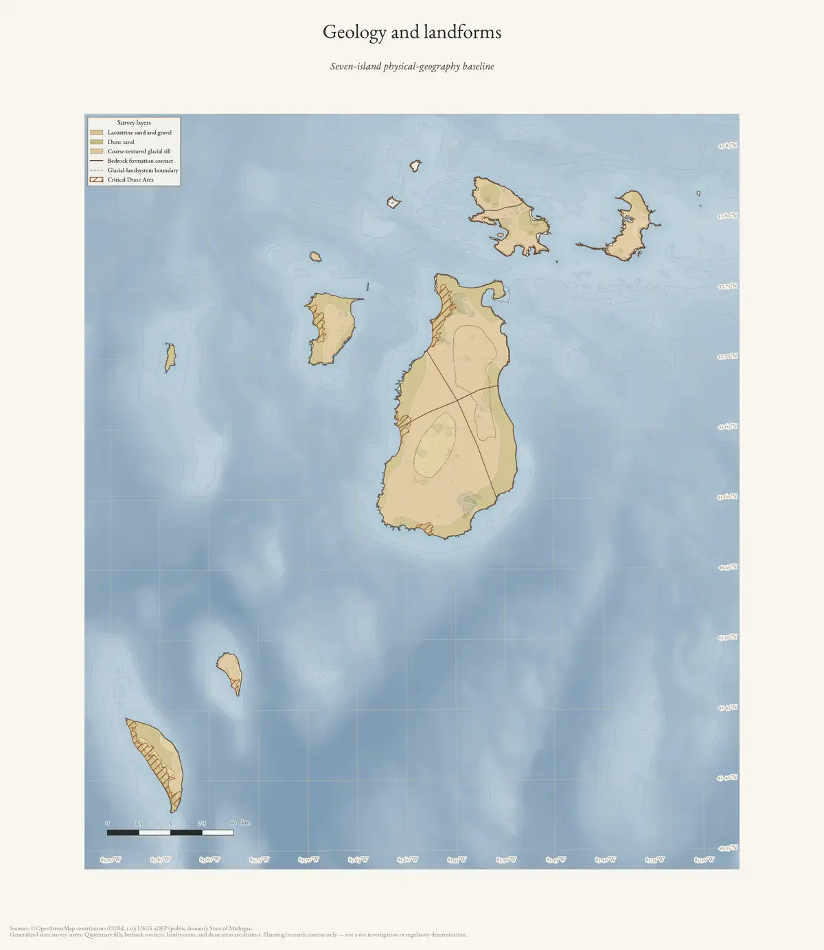
Seven-island reference plate. Quaternary fills, bedrock contacts, glacial-landsystem boundaries, and Critical Dune Areas are separate source layers, not a site investigation or regulatory determination.
Sources
- Archive-generated physical geography plateGeneralized state survey layers rendered in the archive's shared cartographic style. No public copy of this file is known; the archive holds one and can provide it on request.scripts · make_geology_atlas
Added 3 August 2026 · revised 4 August 2026. Recent changes
Cite this article
Beaver Island Archive, “Geology and landforms of the Beaver Island archipelago”, https://beaverislandarchive.org/map/atlas-archipelago-geology/, accessed [date], citing Archive-generated physical geography plate.
Last revised 2026-08-04. Fill in [date] with the date you read it — this page is static and cannot know that.
BibTeX for “Geology and landforms of the Beaver Island archipelago”RIS for “Geology and landforms of the Beaver Island archipelago”