

Atlas · environmental baseline
Environmental Atlas
Start with the seven-island sheet, then move to local plates. Soil fills are SSURGO map units; NWI wetland boundaries and EGLE hydric-soil boundaries are separately drawn; 3DEP hillshade supplies relief context. The layers are useful together precisely because they are not treated as interchangeable.
These are planning and research maps, not parcel determinations, wetland delineations, legal boundaries, or field surveys. Read the wetlands and hydrology and geology and landforms entries for the evidence and limits.
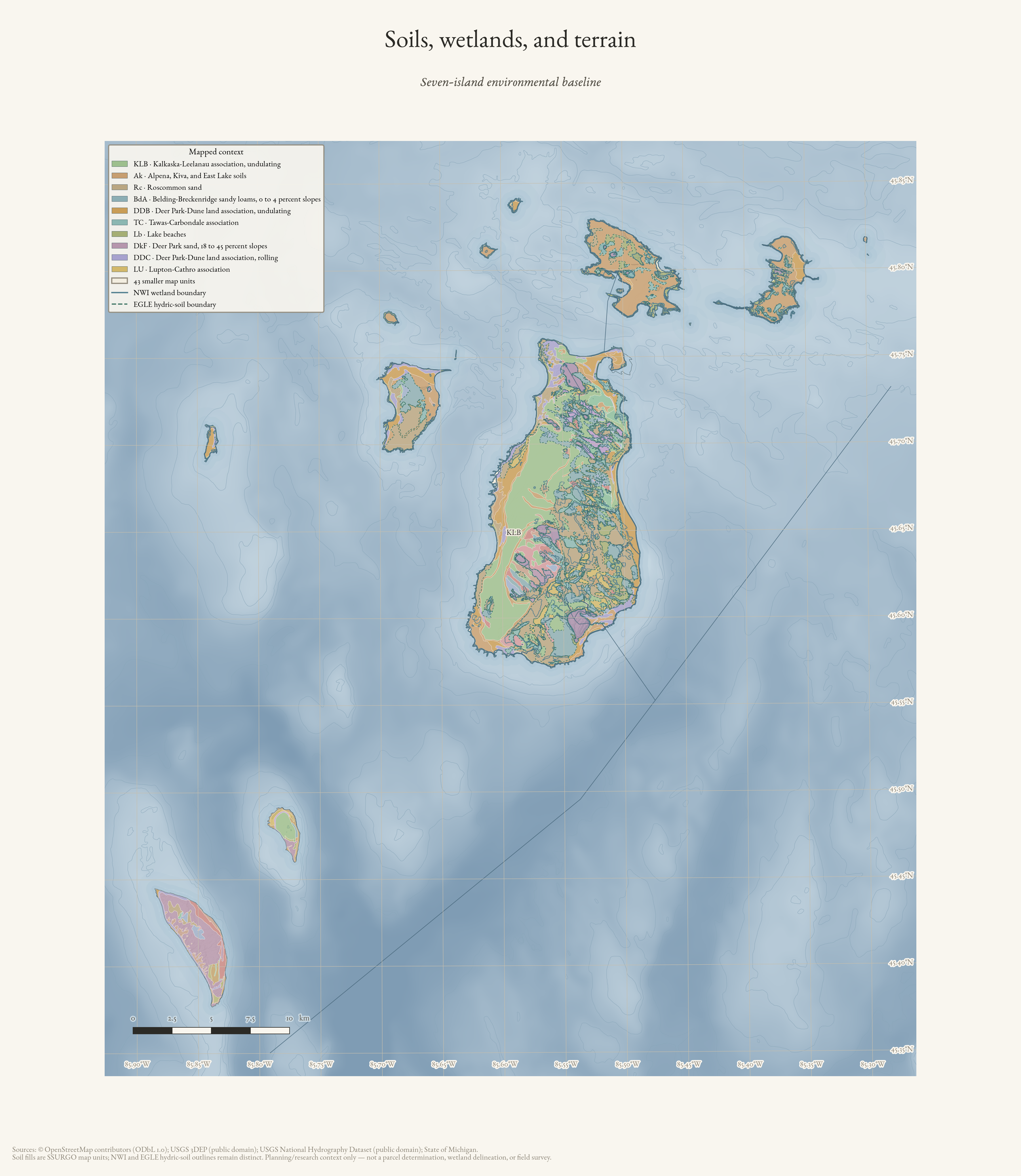
Soils, wetlands, and terrain
Seven-island environmental baseline: SSURGO map units with distinct NWI and EGLE hydric-soil outlines over terrain.
Drawn from the archive's own data in EPSG:3078. Map data © OpenStreetMap contributors (ODbL 1.0); SSURGO soils, USFWS National Wetlands Inventory, Michigan EGLE hydric soils, USGS 3DEP, and National Hydrography Dataset (public domain).
Print PNG · PDF · Read the map record · Provenance & citation