

- Along road
- West Side Drive
- Coordinates
- 45.6691° N, 85.5769° WGoogle Maps: West Side Drive 10.1-acre tractDownload KML
- Eras
- Modern era
- Concepts
- land-useeconomyforestry
- Within
- Beaver Island
Summary
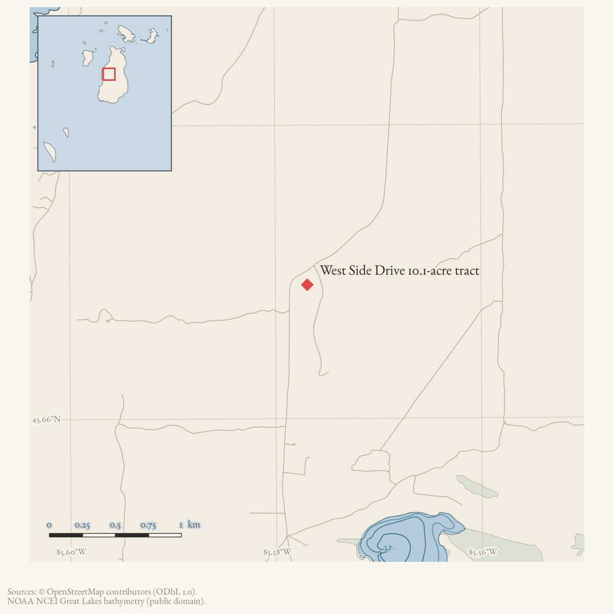
An online Beaver Beacon listing offered 10.1 acres of hardwoods with 700 feet of frontage on West Side Drive, one mile north of Fox Lake. It described high ground, a private road, and a cleared building site and gave an asking price of $45,000.
This record preserves the listing’s approximate location and advertised land characteristics. A current 10.3-acre West Side Road parcel is a plausible candidate based on area, frontage, and relative position, but the match is not confirmed. The record does not establish a completed sale, parcel boundary, survey, ownership continuity, or current improvements.
Map status
The coordinate is the county snapshot’s published point for candidate PIN 012-120-025-00, not a claim that the parcel is definitively the advertised tract. It is useful as a research anchor while the listing’s parcel identity remains unresolved.
Open questions
- Which parcel or deed corresponds to the listing?
- Does the private road have a current name or public access status?
- Was the tract sold or developed after the listing?
Maps for this place
These Atlas plates provide regional context. They do not establish a precise boundary, current ownership, access right, operating status, or field condition.
- EnvironmentSoils, wetlands, hydrography, and terrain
- GeologyGeneralized geology and landforms
- HydrologyMapped water and wetland context
- AccessMapped routes, facilities, and protected areas
- Land surveyPLSS geometry and historic GLO patent-location context
Sources
- Offers 10.1 acres of hardwoods with 700 feet of West Side Drive frontage one mile north of Fox Lake, with a private road and cleared building site, for $45,000 by owner. The listing does not establish a completed sale, parcel identifiers, survey, or current improvements.
- The snapshot contains a 10.3-acre parcel on West Side Road, PIN 012-120-025-00, with a published point near the road location reached approximately one mile north of the held Fox Lake point. The area and proximity make it a candidate only; the snapshot does not prove that it is the advertised 10.1-acre tract, preserves the historic boundary, or establishes the private-road details.county · charlevoix · parcels_arcgis · 2026-08-01 · island_parcels
- Current West Side Road geometry was used to check the listing’s relative “one mile north of Fox Lake” description; the current road name and alignment are not proof of the historical listing’s parcel identity.osm · roads
Added 2 August 2026 · revised 6 August 2026. Recent changes
Cite this article
Beaver Island Archive, “West Side Drive 10.1-acre tract”, https://beaverislandarchive.org/places/west-side-drive-10-acre-tract/, accessed [date], citing Beaver Beacon online classified listing, “West Side Drive 10.1 Acres Hardwoods,” retrieved 2026-08-02. (and 2 further sources listed on the page).
Last revised 2026-08-06. Fill in [date] with the date you read it — this page is static and cannot know that.
BibTeX for “West Side Drive 10.1-acre tract”RIS for “West Side Drive 10.1-acre tract”