

- Coordinates
- 45.7461° N, 85.4984° WGoogle Maps: Sucker PointDownload KML
- Eras
- Modern era
- Concepts
- maritimeshippingfishingtourismenvironment
- Within
- Beaver Island
- Media
- Beaver Island History Map, 1978 revision · Plat of Big Beaver Island, 1901 · Plat of the north end of Beaver Island, 1930s
Summary
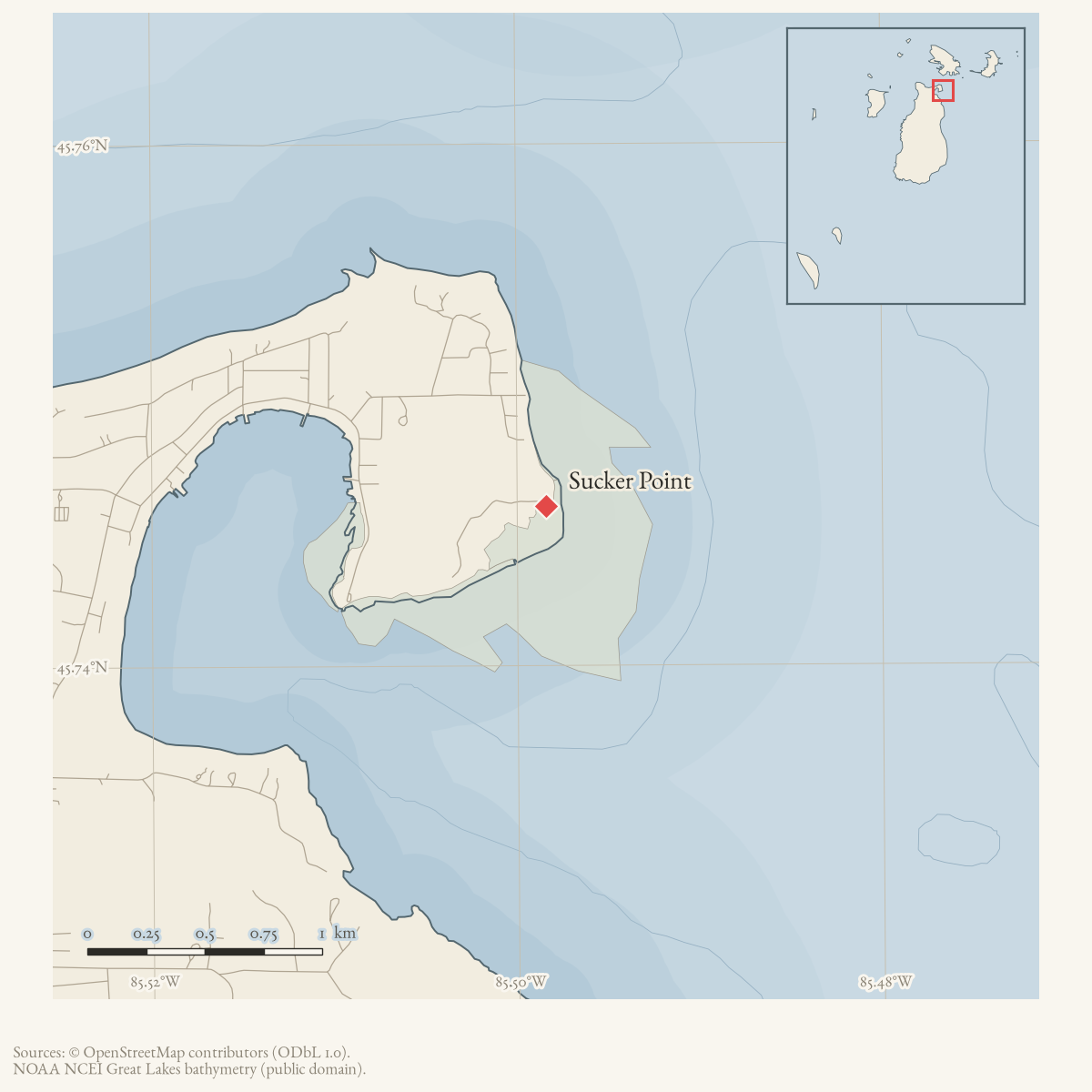
Sucker Point is a GNIS-named cape on Beaver Island at the north side of St. James harbor. Local reporting places it on the route toward Garden Island. In February 1948, two men attempting the customary ice crossing from Sucker Point to Garden Island went through the ice in a truck about 150 feet from shore and were rescued, with help from a dog that reached the stranded driver.
The point was also part of the harbor’s proposed working infrastructure. A March 1966 Charlevoix Courier notice described two 35-foot piers and dredging to five feet, with the site about 900 feet north of the Coast Guard station. Because the item is a public notice, it establishes the proposal and its intended dimensions, not whether the work was completed. A 1947 local report also uses Sucker Point as a north-end beach and trapping reference.
Open questions
- Did the 1966 pier and dredging project proceed, and what later harbor plans or surveys show its result?
- Which shoreline point did the 1948 ice route use, and how did it relate to the Garden Island crossing’s seasonal hazards?
- What is the origin of the name “Sucker Point”?
Sources
- GNIS feature 639010; feature class 'Cape'.federal · gnis · gnis_names
- Charlevoix Courier, February 25, 1948, "Dog Is Hero of Rescue as Truck Goes Through the Ice."Reports that Elston and Herman Pischner went through the ice about 150 feet from shore while making the customary crossing from Sucker Point toward Garden Island; both were rescued. No public copy of this file is known; the archive holds one and can provide it on request.
- Charlevoix Courier, November 5, 1947, Beaver Island local news.Reports that a balloon landed near the beach at Sucker Point while a local resident was checking coyote traps in the north-end area. No public copy of this file is known; the archive holds one and can provide it on request.
- Charlevoix Courier, March 9, 1966, "Pier Planned at St. James."Reports proposed 35-foot piers and five-foot dredging at Sucker Point, about 900 feet north of the Beaver Island Coast Guard station; the notice describes planned work, not proof of construction. No public copy of this file is known; the archive holds one and can provide it on request.
Added 28 July 2026 · revised 1 August 2026. Recent changes
Cite this article
Beaver Island Archive, “Sucker Point”, https://beaverislandarchive.org/places/sucker-point/, accessed [date], citing U.S. Geological Survey, Geographic Names Information System, Domestic Names (Michigan), retrieved 2026-07-28. (and 3 further sources listed on the page).
Last revised 2026-08-01. Fill in [date] with the date you read it — this page is static and cannot know that.