

- Along road
- Gull Island Road
- Coordinates
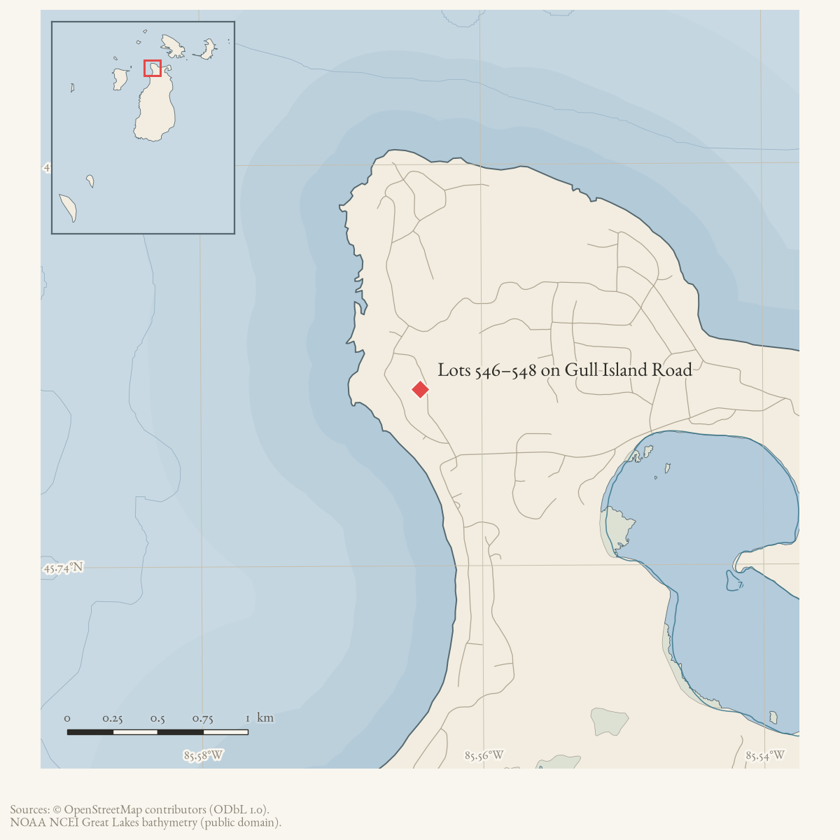
- 45.7488° N, 85.5644° WGoogle Maps: Lots 546–548 on Gull Island RoadDownload KML
- Eras
- Modern era
- Concepts
- land-surveyland-useeconomy
- Within
- Beaver Island
Summary
A May 1977 Beaver Beacon classified advertisement offered Lots 546, 547, and 548 on Gull Island Road. It named John F. Miller of Holland, Ohio as the contact.
The listing identifies lot numbers and a road, but supplies no plat, acreage, price, exact frontage, parcel geometry, or evidence of a completed sale.
Open questions
- Which plat or subdivision contains lots 546–548?
- Do county parcel or plat records locate these lots along the current road?
- Were the lots sold or later renamed or combined?
Maps for this place
These Atlas plates provide regional context. They do not establish a precise boundary, current ownership, access right, operating status, or field condition.
- EnvironmentSoils, wetlands, hydrography, and terrain
- GeologyGeneralized geology and landforms
- HydrologyMapped water and wetland context
- AccessMapped routes, facilities, and protected areas
- Land surveyPLSS geometry and historic GLO patent-location context
Sources
- Offers Lots 546, 547, and 548 on Gull Island Road and gives John F. Miller in Holland, Ohio as the contact. The ad does not supply a plat, acreage, price, exact frontage, or evidence that the lots sold. The holding institution's portal restricts automated access; the archive holds a copy of this issue and can provide it on request.data1 · beaver-island-archive · beaver_beacon · 1977-05_Beaver-Beacon
- The held twelve-page issue scan is paired with the OCR source and confirms the published notice or report; it does not expand the source-specific identity, event, or outcome claims.data1 · beaver-island-archive · scans · beaver_beacon · issues · 1977-05_Beaver-Beacon
- The snapshot contains Port St. James No. 7 lots 546, 547, and 548 on Gull Island Road. The point at approximately -85.5643977, 45.7488009 is the mean of their current parcel-record centroids and is a representative cluster point, not a plat centroid, lot boundary, completed-sale proof, or ownership assertion.county · charlevoix · parcels_arcgis · 2026-08-01 · island_parcel_attributes
Added 2 August 2026 · revised 3 August 2026. Recent changes
Cite this article
Beaver Island Archive, “Lots 546–548 on Gull Island Road”, https://beaverislandarchive.org/places/gull-island-road-lots-546-548-1977/, accessed [date], citing Beaver Beacon, May 1977, classified advertising. (and 2 further sources listed on the page).
Last revised 2026-08-03. Fill in [date] with the date you read it — this page is static and cannot know that.
BibTeX for “Lots 546–548 on Gull Island Road”RIS for “Lots 546–548 on Gull Island Road”