

- Along road
- Eagle Hill Road · Barneys Lake Road North
- Coordinates
- 45.7226° N, 85.5694° WGoogle Maps: McCauley’s Point 4.6-acre parcelDownload KML
- Eras
- Modern era
- Concepts
- land-surveyland-useeconomyrecreation
- Within
- Beaver Island
Summary
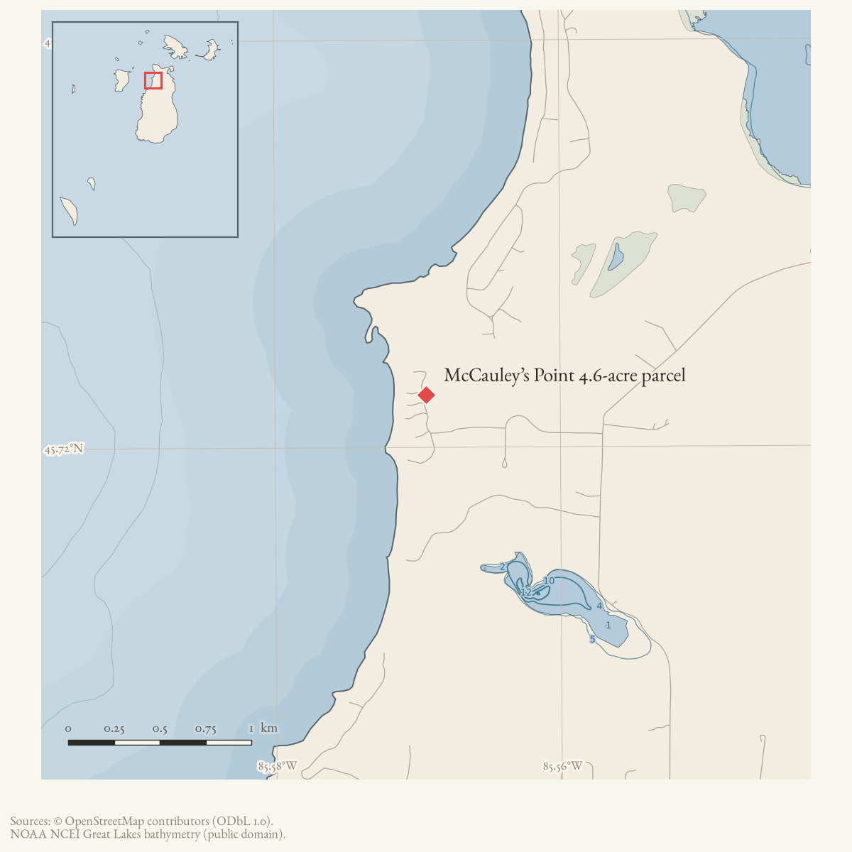
In July 2002, Ed Wojan Realty advertised a 4.6-acre West Side parcel south of McCauley’s Point with 200.27 feet of sandy beach frontage. The listing described a high building site, critical-dune setting, and access by a private drive connecting to Eagle Hill Road off Barney’s Lake Road. It also said the Kuebler Trail crossed the interior and gave an asking price of $275,000.
The record preserves the listing’s road-access and landscape claims; it does not establish a completed sale, parcel polygon, subdivision record, or current trail alignment.
Open questions
- Which deed or subdivision lot corresponds to the listing?
- Is the private drive public, named, or still accessible?
- Can the referenced survey and McCauley’s Point Subdivision sketch be located?
Maps for this place
These Atlas plates provide regional context. They do not establish a precise boundary, current ownership, access right, operating status, or field condition.
- EnvironmentSoils, wetlands, hydrography, and terrain
- GeologyGeneralized geology and landforms
- HydrologyMapped water and wetland context
- AccessMapped routes, facilities, and protected areas
- Land surveyPLSS geometry and historic GLO patent-location context
Sources
- Offers a 4.6-acre West Side parcel south of McCauley’s Point with 200.27 feet of sandy beach frontage, a high building site, and a private drive connecting to Eagle Hill Road off Barney’s Lake Road. It mentions a survey copy and McCauley’s Point Subdivision sketch but does not supply them, a deed, completed sale, or exact polygon. The holding institution's portal restricts automated access; the archive holds a copy of this issue and can provide it on request.data1 · beaver-island-archive · beaver_beacon · 2002-07_Beaver-Beacon
- The held thirty-eight-page issue scan is paired with the OCR source and confirms the published notice or report; it does not expand the source-specific identity, event, or outcome claims.data1 · beaver-island-archive · scans · beaver_beacon · issues · 2002-07_Beaver-Beacon
- The snapshot contains parcel 012-232-003-30 at approximately -85.5694168, 45.7225789: 4.6 acres, with a legal description running 200 feet along Lake Michigan shore. Those acreage and frontage figures closely match the 2002 listing and make this the strongest current parcel candidate; its representative point is used as the property anchor. The snapshot labels the site 36315 McCauley’s Point Road, while the listing describes a private drive connecting to Eagle Hill Road off Barney’s Lake Road; the point is therefore an approximate likely-parcel locator, not a surveyed boundary or proof that the 2002 access description and current road address are identical.county · charlevoix · parcels_arcgis · 2026-08-01 · island_parcel_attributes
Added 2 August 2026 · revised 6 August 2026. Recent changes
Cite this article
Beaver Island Archive, “McCauley’s Point 4.6-acre parcel”, https://beaverislandarchive.org/places/eagle-hill-road-mccauleys-point-parcel-2002/, accessed [date], citing Beaver Beacon, July 2002, “Ed Wojan Realty.” (and 2 further sources listed on the page).
Last revised 2026-08-06. Fill in [date] with the date you read it — this page is static and cannot know that.
BibTeX for “McCauley’s Point 4.6-acre parcel”RIS for “McCauley’s Point 4.6-acre parcel”