

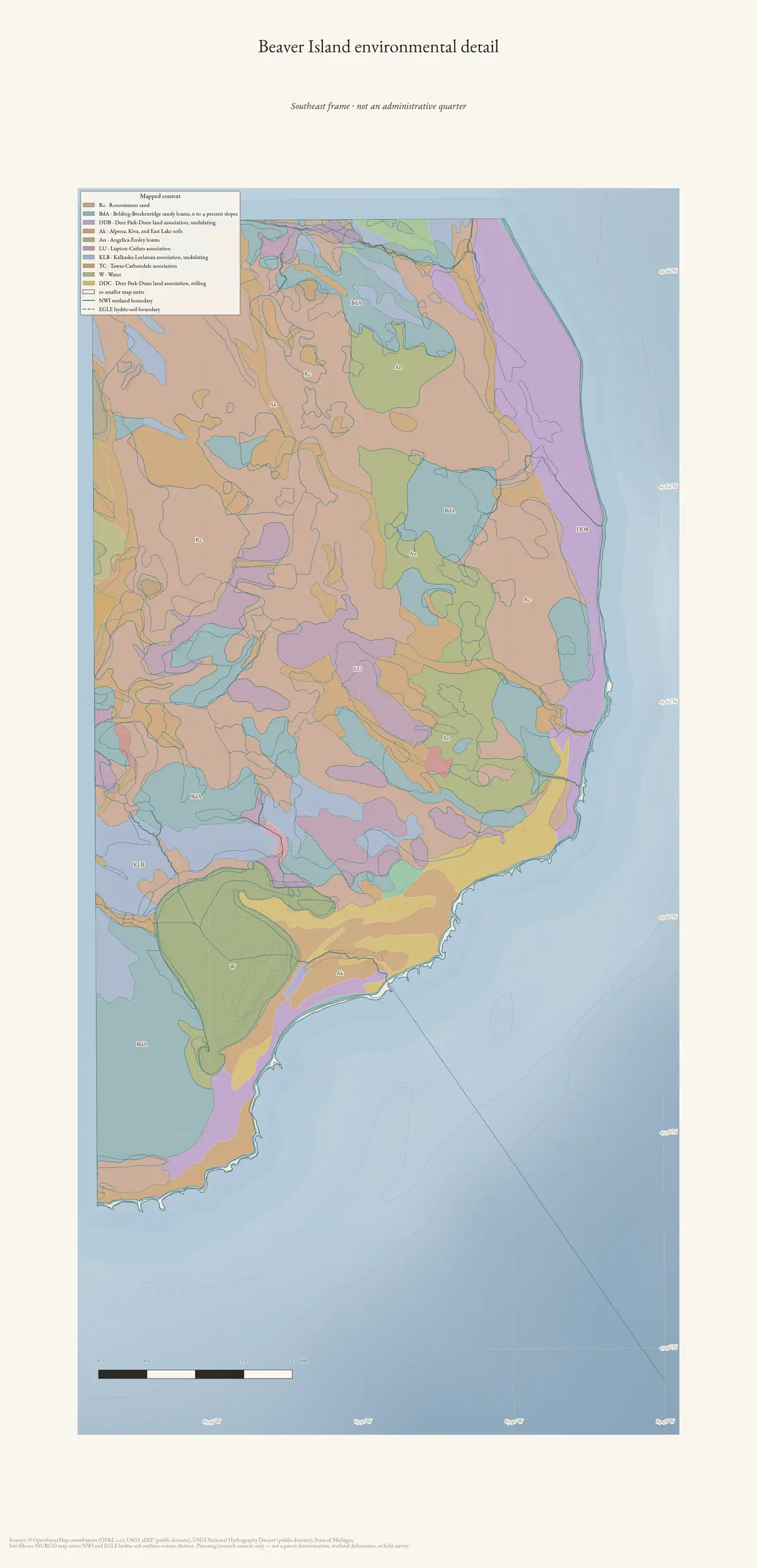
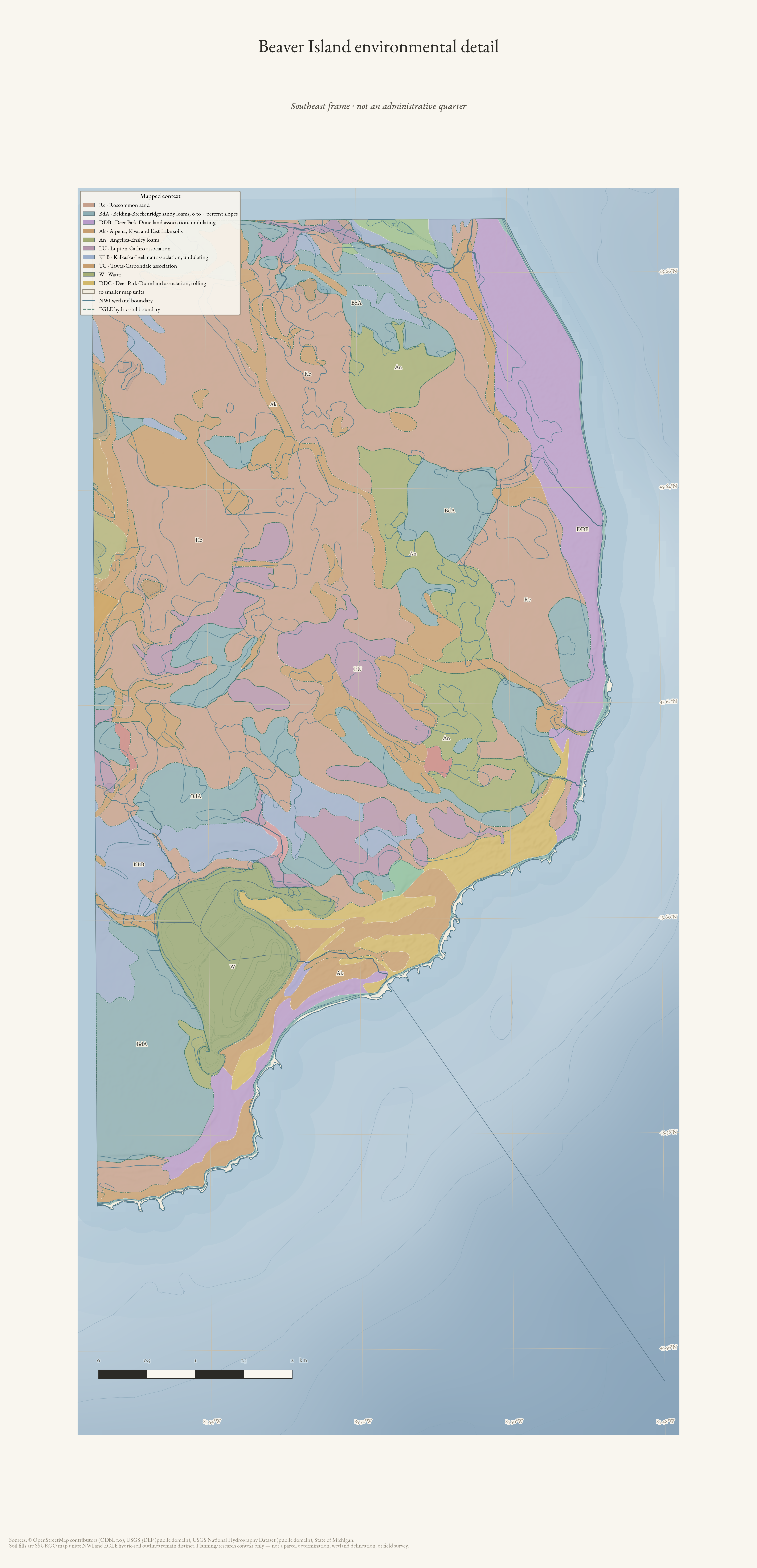
A southeast detail frame for reading SSURGO map units, wetland context, hydrography, and terrain on Beaver Island; it is not an administrative quarter.
Visual descriptionwritten by a machine · unchecked
A tall, vertically oriented environmental map plate shows a coastal area surrounded by pale blue water. Irregular colored polygons cover the land, with thin boundary lines, small labels, waterways, a legend in the upper left, and a scale bar near the bottom. Faint grid lines and contour-like shading extend across the water.
A model wrote this. It was shown the image and the catalogue record together, and asked to keep them apart — what it saw is here, what the record told it is under "taken from the record" below. It is still wrong often enough to matter, about who is pictured, where, when, and what is happening. Read it as a way to find the image, never as evidence about it. If you can correct it, please do: write to michael.bommarito@gmail.com, or see how corrections work. Someone who recognises a face or a shoreline knows more than the model did.
Drawn from the archive's own data in EPSG:3078. Map data © OpenStreetMap contributors (ODbL 1.0); SSURGO soils, USFWS National Wetlands Inventory, Michigan EGLE hydric soils, USGS 3DEP, and National Hydrography Dataset (public domain).
3,600 × 7,451 px · PNG · 4.2 MB
Subjects and keywords
Text in the image
Transcribed from the object itself.
Beaver Island environmental detail
Southeast frame • not an administrative quarter
Mapped context
Taken from the record
Not observed in the image — supplied by the archive's own catalogue, and repeated here so the two stay distinguishable.
Catalogue record identifies this as a southeast detail frame in the Environmental Atlas detail collection, drawn from archive data with OpenStreetMap, SSURGO, USFWS National Wetlands Inventory, Michigan EGLE hydric soils, USGS 3DEP, and National Hydrography Dataset sources. The archive description states that it is not an administrative quarter.
Could not make out
Stated rather than guessed at.
Most legend entries, map labels, credits, and other fine print are too small to transcribe reliably.
Rights and credit
CC BY 4.0 for the drawing; underlying data under its own terms (see credit)
Credit this to Drawn from the archive's own data in EPSG:3078. Map data © OpenStreetMap contributors (ODbL 1.0); SSURGO soils, USFWS National Wetlands Inventory, Michigan EGLE hydric soils, USGS 3DEP, and National Hydrography Dataset (public domain). when you use it.
Stated by this archive, which drew the plate.
Provenance
- Held by
- Beaver Island Archive
- Collection
- Atlas plates
- Named on the record
- Beaver Island Archive; © OpenStreetMap contributors; USGS, USFWS, USDA
- Drawn by
- scripts/make_environmental_atlas.py
- Title from
- this archive, which drew the plate
The file
| Rendition | Format | Extent | Size | SHA-256 |
|---|---|---|---|---|
| Master | PNG | 3,600 × 7,451 px | 4.2 MB | 742f94de4d87… |
Checksums are the values recorded when each copy was taken, or computed from the bytes held where the retrieval recorded no checksum for that particular file.
Download
- Web-sized image1200 × 2484 · 100 KB · WebP
- Print PNG4.2 MB
- Print PDF5.1 MB
In this archive
- Written aboutBeaver Island environmental detail — Southeast
- DepictsBeaver Island
- DepictsGeology and landforms
- DepictsWetlands, inland waters, and hydrology
- Published on/atlas/environment/beaver-island/
Cite this
Beaver Island Archive; © OpenStreetMap contributors; USGS, USFWS, USDA. “Beaver Island environmental detail — Southeast”. Beaver Island Archive. Beaver Island Archive, https://beaverislandarchive.org/media/plate/beaver-island-southeast-environment/.
Built only from what the archive recorded: the names on the record, the title as recorded, the date if one was recorded, this page, and the date the copy was taken. Nothing is filled in to satisfy a citation style.