

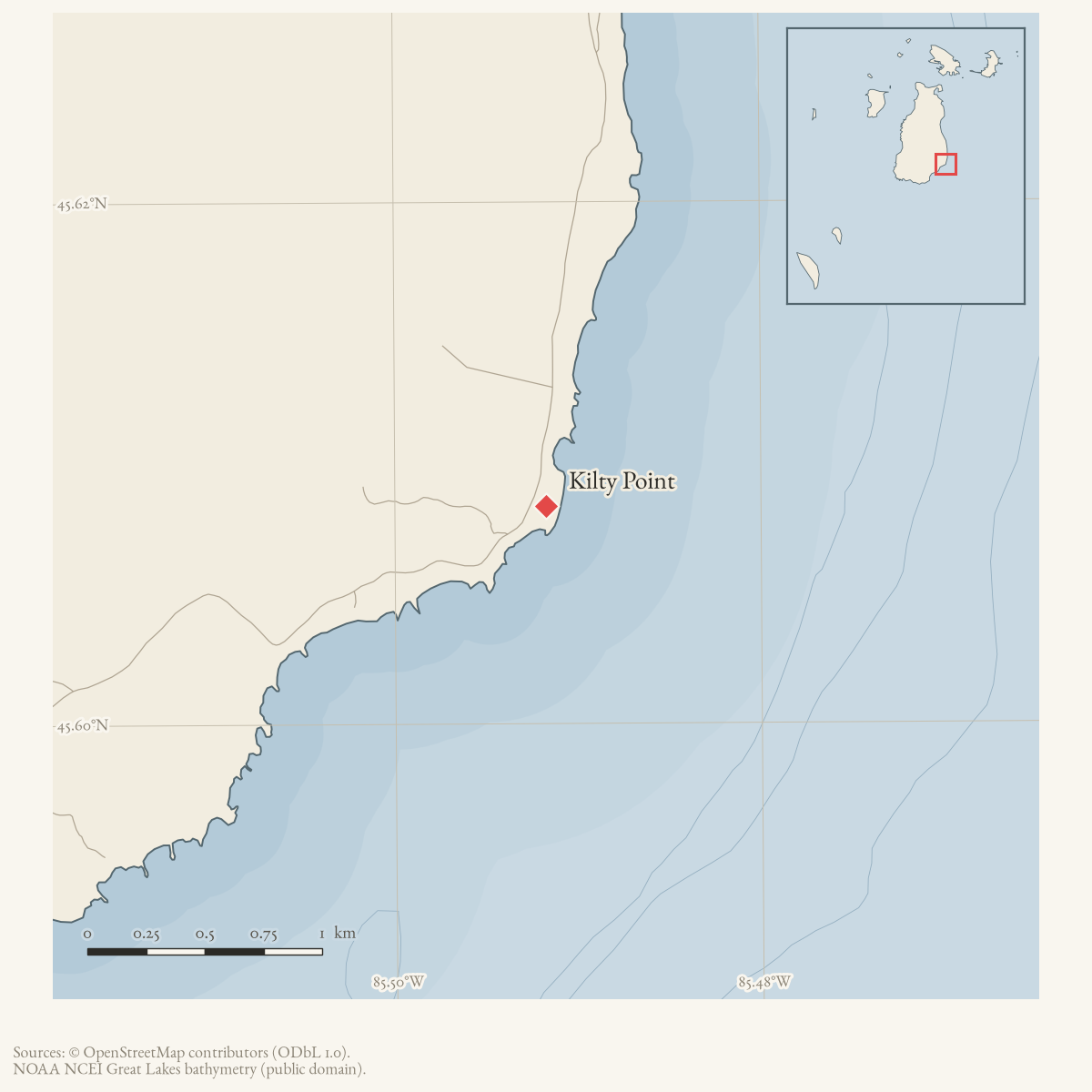
- Coordinates
- 45.6083° N, 85.4917° WGoogle Maps: Kilty PointDownload KML
- Eras
- Modern era
- Concepts
- toponymy
- Within
- Beaver Island
- Media
- Beaver Island History Map, 1978 revision · Plat of Big Beaver Island, 1901 · Plat of the south end of Beaver Island, 1930s
Summary
USGS GNIS identifies Kilty Point as a cape and records the name’s association with Pat Kilty, who worked with the crew that first surveyed Beaver Island in 1845. The 2023 Beaver Island Master Plan labels the feature “Kilty’s Pt.” on its map. The spelling variants in GNIS and the map label should be retained as part of the place’s toponymic record.
The 1978 Historical Map adds that Pat’s son Pete captained Pere Marquette 18 when it sank. Contemporary September 1910 reports independently establish Captain Peter Kilty’s command and loss with the vessel and connect him to an island family through his sister, Mrs. M. J. Bonner. Neither report identifies Pat as his father. The map’s two claims are therefore supported separately, but their father-son connection remains unproved.
Open questions
- Can the original GLO survey notebooks document Pat Kilty’s role directly?
- Do civil, parish, census, or probate records establish Peter Kilty as Pat Kilty’s son?
- Which of the GNIS variants, if any, appears in dated local sources?
Sources
- GNIS feature 1623179; feature class 'Cape'.federal · gnis · gnis_names
- Feature 1623179 description names Pat Kilty, who worked with the crew that first surveyed the island in 1845.federal · gnis · gnis_feature_descriptions
- Variant names: Kelty Point; Keltys Point; Kitty Point.federal · gnis · gnis_variant_names
- Map label “Kilty's Pt.”
- Charlevoix Courier, September 14, 1910, “One of the Worst.”Contemporary casualty report names Peter Kilty as captain of Pere Marquette car ferry No. 18 when it sank on September 9, 1910. It does not state that Peter was Pat Kilty’s son. No public copy of this file is known; the archive holds one and can provide it on request.
- Charlevoix County Herald, September 17, 1910, marine-disaster report.Contemporary report names Captain Peter Kilty and identifies him as a brother of Mrs. M. J. Bonner of St. James; this island-family connection still does not establish the map’s father-son claim. No public copy of this file is known; the archive holds one and can provide it on request.
- Described in this archive: Beaver Island History Map, 1978 revision.Says Pat Kilty helped survey the island in 1845 and that his son Pete captained P.M. 18 when she sank. The survey tradition and Peter’s command are separately supported; the kinship bridge remains unverified.
Added 28 July 2026 · revised 7 August 2026. Recent changes
Cite this article
Beaver Island Archive, “Kilty Point”, https://beaverislandarchive.org/places/kilty-point/, accessed [date], citing U.S. Geological Survey, Geographic Names Information System, Domestic Names (Michigan), retrieved 2026-07-28. (and 6 further sources listed on the page).
Last revised 2026-08-07. Fill in [date] with the date you read it — this page is static and cannot know that.