

- Eras
- Pre Settlement era
- Concepts
- environmentforestswetlandscartography
Summary
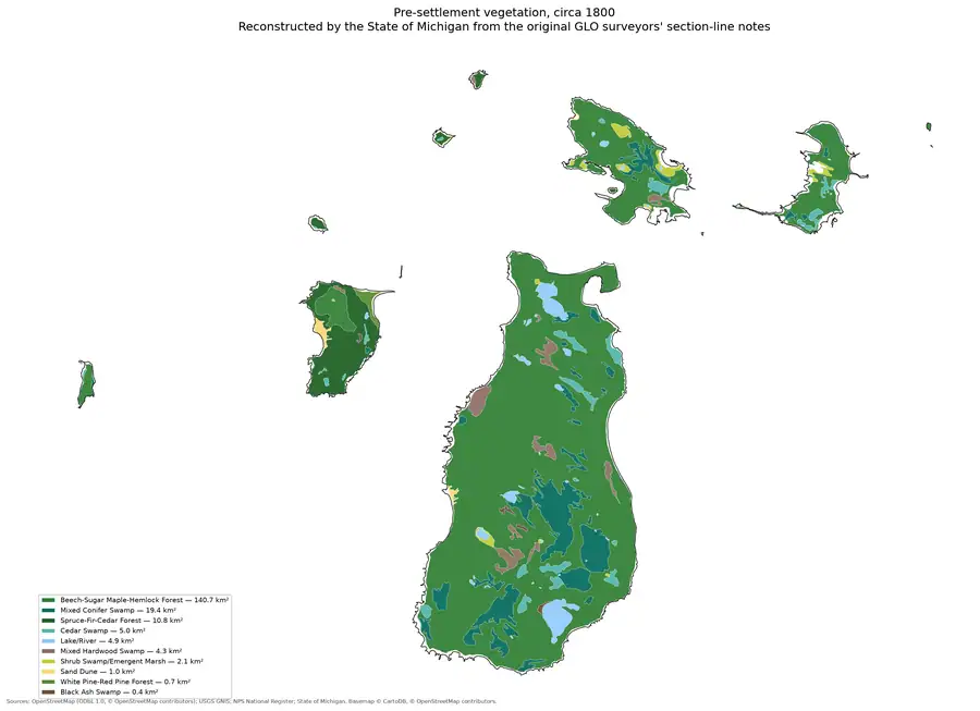
A single plate showing reconstructed pre-settlement vegetation across the Beaver Island archipelago as it stood circa 1800, before American settlement. The State of Michigan derived the reconstruction from the original General Land Office surveyors’ section-line notes, so the plate is a cartographic rendering of the same survey record that the archive’s GLO ecology material draws on.
Open questions
- None outstanding.
Sources
- Archive-generated plate: pre-settlement vegetation, circa 1800.Rendered by this archive from the State of Michigan's circa-1800 land-cover reconstruction, which the State derived from the original General Land Office surveyors' section-line notes. The legend gives ten cover types with their areas, the largest being beech-sugar maple-hemlock forest at 140.7 square kilometres. CC BY 4.0 for the drawing; the underlying data carries its own terms.src · beaver_island_history · figures
Added 12 August 2026. Recent changes
Cite this article
Beaver Island Archive, “Pre-settlement vegetation of the Beaver Island archipelago, circa 1800”, https://beaverislandarchive.org/map/presettlement-vegetation-c1800/, accessed [date], citing Archive-generated plate: pre-settlement vegetation, circa 1800..
Last revised 2026-08-12. Fill in [date] with the date you read it — this page is static and cannot know that.
BibTeX for “Pre-settlement vegetation of the Beaver Island archipelago, circa 1800”RIS for “Pre-settlement vegetation of the Beaver Island archipelago, circa 1800”