

- Eras
- Modern era
- Concepts
- cartographyenvironment
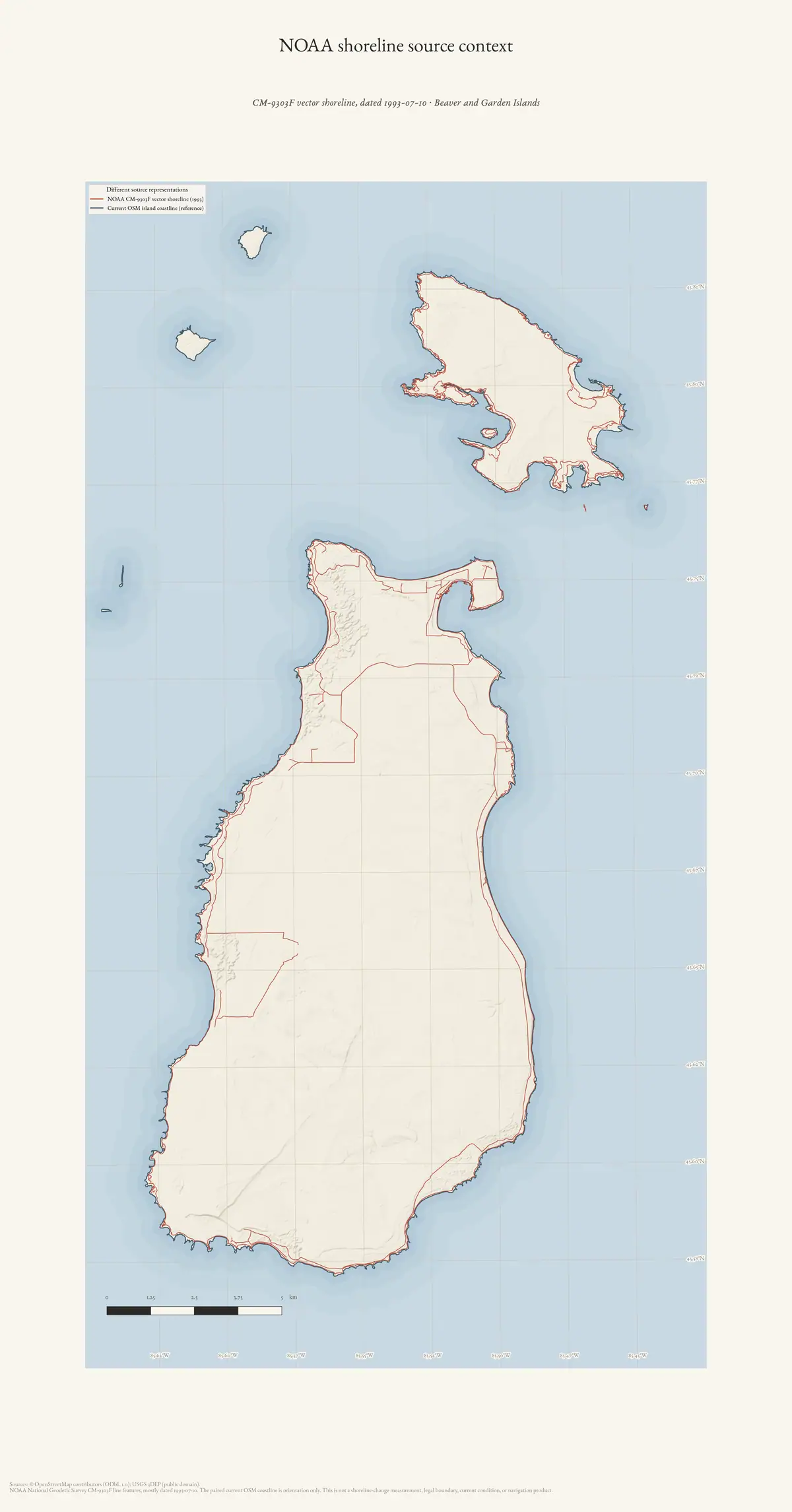
This plate retains NOAA CM-9303F as a dated source representation. It is not a shoreline-change measurement, a current shoreline or condition inventory, a legal or property boundary, or a navigation product.
Sources
- NOAA National Geodetic Survey, Shoreline Mapping Program CM-9303FOfficial vector shoreline package; line features principally carry source date 1993-07-10. No public copy of this file is known; the archive holds one and can provide it on request.federal · noaa_shoreline · cm-9303f · extracted · softcopyl1
- Archive-generated shoreline source-context plateCurrent OSM coastline is only an orientation reference; no change measurement is derived. No public copy of this file is known; the archive holds one and can provide it on request.scripts · make_shoreline_atlas
Added 4 August 2026. Recent changes
Cite this article
Beaver Island Archive, “NOAA shoreline source context for Beaver and Garden Islands, 1993”, https://beaverislandarchive.org/map/atlas-beaver-garden-noaa-shoreline-1993/, accessed [date], citing NOAA National Geodetic Survey, Shoreline Mapping Program CM-9303F (and 1 further source listed on the page).
Last revised 2026-08-04. Fill in [date] with the date you read it — this page is static and cannot know that.
BibTeX for “NOAA shoreline source context for Beaver and Garden Islands, 1993”RIS for “NOAA shoreline source context for Beaver and Garden Islands, 1993”